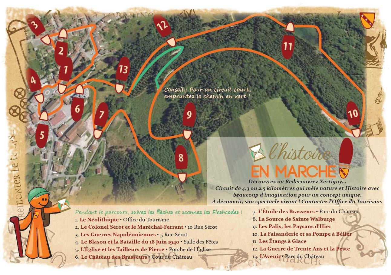
Sentier de découverte Histoire en marche
Walks and hikes
,
Walking/pedestrian
in Xertigny
4.4
km
Loop
- See all reviews
- 146 meters of difference in height
-
- Start altitude : 486 m
- End altitude : 486 m
- Maximum altitude : 559 m
- Minimum altitude : 474 m
- Total positive elevation : 146 m
- Total negative elevation : -146 m
- Max positive elevation : 39 m
- Min positive elevation : -31 m
